Ever walked a fence line and wondered if it really matches the legal boundary on paper? When you are buying rural acreage in Red River County, that question matters. A clear survey can prevent costly mistakes, protect your access, and support clean title for financing and resale. In this guide, you will learn why surveys matter, how metes-and-bounds descriptions work, what survey type to order, expected timelines and costs, and the local steps that keep you protected. Let’s dive in.
Why surveys matter in Red River County
A land survey turns the legal description in a deed into a mapped boundary you can use on the ground. Most rural tracts here are described by metes-and-bounds language tied to monuments and legal calls. A survey retraces that description and sets or finds corner markers so you know where your land starts and ends.
Surveys reduce financial and legal risk. They can reveal encroachments, unrecorded drives, access issues, easements, and rights-of-way that affect how you use the land. They also help your title company evaluate exceptions and your lender decide what it will finance.
In Texas, mineral rights are often severed from surface rights. A surface survey does not determine mineral ownership. It helps you locate boundaries, access points, and improvements that affect your surface use. Review deed language for mineral reservations and consult your title company or attorney when needed.
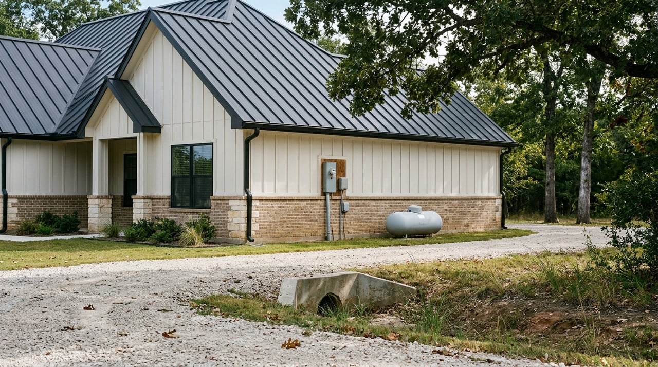
If you skip an accurate survey, you can face real problems later. Common issues include structures or fences crossing the line, disputed boundaries with neighbors, or a lack of legal access from a public road. A current survey is one of the best tools to prevent or resolve these risks.
Survey types you will see
Different goals call for different surveys. Here are the most common types you will see for Red River County acreage.
Boundary or retracement survey
This is the standard survey for most rural purchases. The surveyor reviews your deed, retraces the metes-and-bounds description, finds or sets monument corners, and shows the boundary on a plat. It is the foundation for knowing what you are buying.
ALTA/NSPS survey
This is a comprehensive survey used for commercial deals and some lender requirements. It follows national ALTA/NSPS standards. It can include easements, visible improvements, and floodplain details, depending on the options you select and your title commitment. Ask your lender and title company if this is required.
Mortgage or loan closing survey
Some lenders request a lender-focused survey that confirms boundary lines and improvements relevant to underwriting. The scope can vary by lender. Clarify what level of detail they need before you order.
Topographic survey
This survey adds elevation and contour data. It is useful for site planning, roads, ponds, utilities, and building. Not every land purchase needs topo, but it can save time and money if you plan to develop.
Subdivision or platting survey
If you are splitting land into new parcels, you will need a subdivision or platting survey. This involves an approval process and a recorded plat. Check local rules before you start.
As-built or improvement survey
This survey verifies where structures, drives, or fences sit in relation to the boundary. It is helpful if you suspect an encroachment or want to confirm setbacks before building.
Metes-and-bounds explained
Many Texas deeds describe land using metes-and-bounds. Understanding the basics helps you read a survey and ask good questions.
Key parts of a description
- Point of Beginning, or POB: A fixed starting point on the boundary. Every course begins from here.
- Courses and calls: Each course states a direction and a distance, such as N 27° 18' W, 450.00 feet.
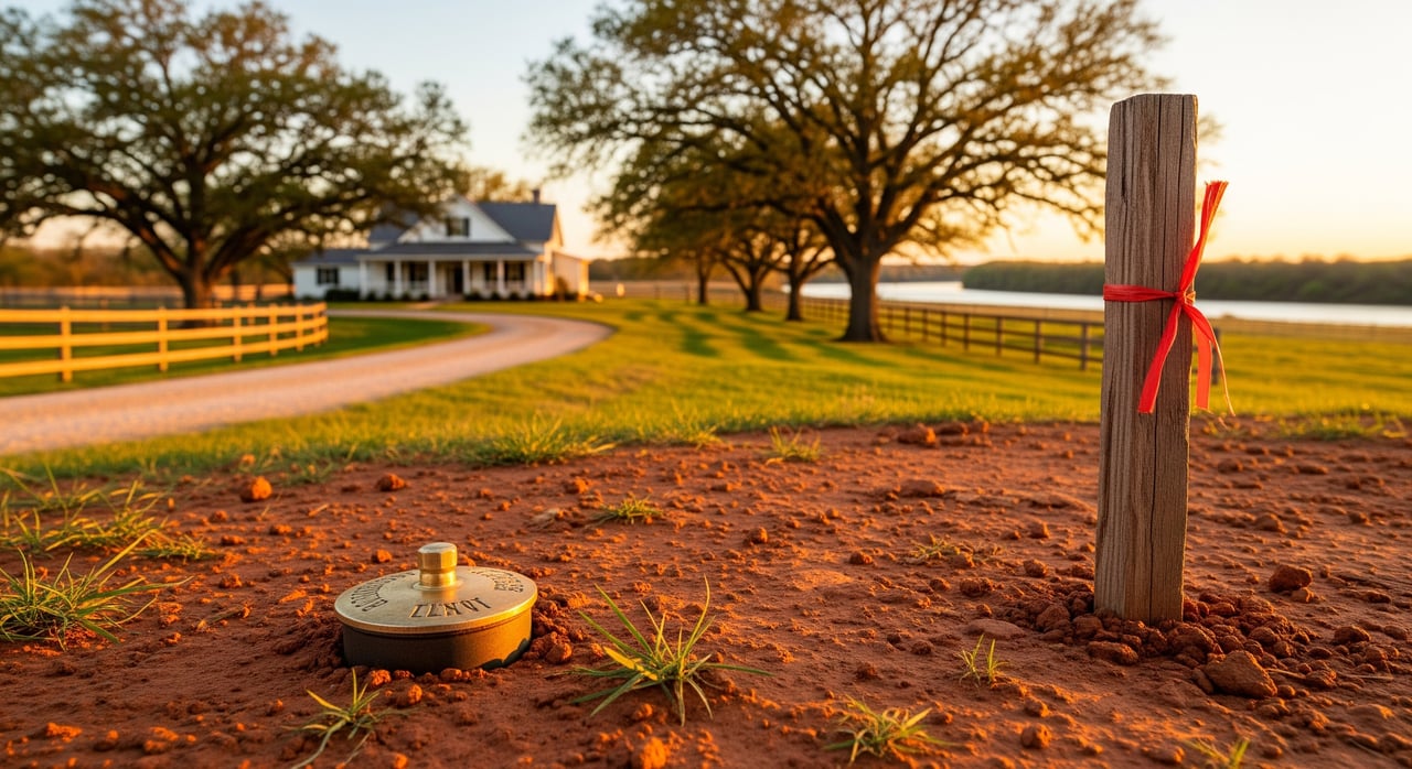
- Monuments: Physical markers like iron rods, stones, fence posts, or a highway right-of-way that tie the description to the ground.
- Ties to original surveys or abstracts: Rural Texas deeds often reference an original survey name or an abstract number.
- Adjoining properties: Many descriptions call along neighboring surveys or grant lines.
An example might read: “Beginning at an iron rod found at the southeast corner of the Smith survey, thence N 00°12' W 660.00 feet to an iron rod set; thence E 1320.00 feet to an oak tree; thence S 00°12' E 660.00 feet to an iron rod found; thence W 1320.00 feet to the Point of Beginning.”
Why it gets tricky
Monuments can deteriorate or disappear, and older deeds sometimes conflict or contain errors. Units and coordinate systems can vary between old and new documents. A licensed surveyor researches the records, looks for field evidence, and makes a professional judgment to fix the boundary. If evidence is unclear, the surveyor documents conflicts and can recommend next steps, such as a boundary line agreement or legal action.
The survey process and timeline
Ordering a survey is straightforward when you know the steps.
- Order and engagement: You, the seller, title company, or lender engages a licensed surveyor and sets the scope in writing.
- Title and deed research: The surveyor reviews deeds, plats, prior surveys, easements, and tax maps from the Red River County Clerk and other sources.
- Field work: The crew locates monuments, measures the site, and stakes corners.
- Drafting and certification: The surveyor prepares a plat with bearings, distances, monuments, and improvements, and signs a certificate.
- Delivery: You receive the final survey and share it with your title company and lender. Plats for subdivisions are recorded. Standard boundary surveys are usually not recorded.
- Issue resolution: If an encroachment or access concern appears, your team can negotiate solutions, document agreements, or seek legal remedies.
How long it takes
- Simple lots or straightforward small tracts: about 1 to 3 weeks.
- Larger rural tracts or complex retracements: 2 to 8 weeks or more.
- ALTA/NSPS or title heavy surveys: timelines can extend due to extra research and lender or title review.
What it costs
Costs vary by acreage, terrain, record quality, number of corners, and scope.
- Small rural lots, 1 to 5 acres: several hundred to a couple thousand dollars.
- Typical rural acreage, tens of acres: low thousands to several thousand dollars.
- Large or complex tracts, multiple parcels, or ALTA: several thousand up to 10,000 dollars or more.
Get written estimates from multiple licensed surveyors and confirm what is included. Ask about monumentation, the final plat, any filing costs, and whether follow-up staking is covered.
Reduce disputes and protect value
A current survey helps you avoid boundary disputes and surprise costs. Clear, documented lines reduce neighbor conflicts and provide evidence if you ever need it. Early discovery of encroachments gives you time to negotiate or adjust plans. Confirmed access and easements help you secure financing and plan improvements. A survey can also narrow title insurance exceptions, which protects your investment and your future buyer’s confidence.
Local steps for Red River County buyers
Use these practical steps as you evaluate property and move toward closing.
- Ask for the current deed and any recorded surveys or plats before you tour.
- Confirm whether the property has public road frontage or a recorded access easement.
- Review your title commitment for survey-related exceptions and easements.
- Consider a boundary or ALTA survey before closing if the tract is large, includes improvements, you plan to develop, or your title company recommends it.
- If corners will be marked, make sure gates are accessible and plan for off-road terrain during field work.
- Check flood zones through official FEMA resources if floodplain could affect your plans.
Choosing the right surveyor
Work only with a licensed Professional Land Surveyor. In Texas, surveyors are regulated by the Texas Board of Professional Land Surveying. You can also look for professionals through the Texas Society of Professional Surveyors.
A quick checklist helps you order with confidence:
- Licensing: Confirm the surveyor’s active Texas license.
- Scope: Define the type of survey and show your deed and title commitment.
- Standards: Ask if an ALTA/NSPS survey is required by your lender.
- Deliverables: Confirm a signed certificate, a plat, and monumentation of corners.
- Timeline and cost: Get a written estimate with expected delivery dates.
- Follow-up: Ask about restaking or additional site visits if needed.
When minerals and easements matter
Surface surveys map boundaries and improvements. They do not show mineral ownership. In our area, mineral rights are often reserved by past owners. Read the deed and your title commitment for reservations and consult with your title company or a real estate attorney on mineral questions.
Easements and rights-of-way can affect how you access and use the land. Your survey can show visible evidence of use and recorded easements from the title commitment. Address any concerns before closing to avoid costly fixes later.
Work with a local guide
Buying acreage in Red River County is exciting, but the details matter. A clear survey, a clean title, and practical local guidance give you peace of mind and protect your plans for the land. If you want help reading a metes-and-bounds description, scoping the right survey, or coordinating with your title company, reach out to Meagen Smith. You will get patient, local support tailored to rural property in our part of Northeast Texas.
FAQs
Who pays for a land survey in Red River County?
- It is negotiated in the contract, but buyers often pay when a survey is required by their lender or desired by the buyer.
Will a survey show mineral rights on my property?
- No, surveys show surface boundaries and improvements; check deeds and title documents for mineral reservations.
What if my fence is not on the boundary line?
- Fences are not always legal boundaries; a retracement by a licensed surveyor is the primary tool to confirm the line and guide any agreements.
Do I need an ALTA survey to buy acreage?
- Only if your lender or title insurer requires it; otherwise a boundary survey often meets a typical rural buyer’s needs.
How long do rural surveys take in Red River County?
- Simple tracts can take 1 to 3 weeks; larger or complex tracts often take 2 to 8 weeks or more.
What happens if the land has no legal access?
- Your survey and title work can reveal access issues; solutions may include recorded easements or legal action, so address this before closing.