Looking at acreage near the Red River in Arthur City can feel exciting and a little complicated at the same time. You may see open ground, water views, and room to build or enjoy the land, but river property comes with questions that do not always show up in a basic listing. If you want to buy with more confidence, it helps to know what to verify before you close. Let’s dive in.
Why river acreage needs extra review
Buying acreage near the river is different from buying a typical rural tract. In Arthur City, you are not just evaluating land size and price. You are also looking at floodplain risk, access, soil conditions, utilities, water rights, and the exact legal boundary near the river.
A good way to think about it is this: the property is a mix of land, water, access, and paperwork. If one of those pieces is unclear, your plans for building, recreation, livestock, or long-term holding can get harder and more expensive than expected.
Arthur City river setting
Arthur City is an unincorporated community in extreme north central Lamar County, located on the Red River near Farm Road 197 and U.S. Highway 271. The river corridor is a major part of the area’s appeal, but it also creates more parcel-by-parcel variation than many buyers expect.
The USGS monitoring location at Arthur City reports a streamgage elevation of 374.85 feet above NAVD 1988. That number can help you understand the broader river setting, but it is not a substitute for parcel-specific topography, a survey, or elevation work for the tract you want to buy.
Check legal access first
One of the biggest mistakes acreage buyers make is assuming access is obvious because they can see a driveway, fence opening, or riverbank. On river property, legal access should be confirmed early through the deed, survey, and any recorded easements.
Texas Parks and Wildlife explains that public water and private land are treated differently under Texas law. Even if land touches the river, that does not give the public a right to cross private property. For you as a buyer, that means river frontage does not automatically answer where you can legally enter, cross, fence, or use the property.
What to verify about access
- Recorded road access
- Road frontage details
- Driveway easements
- Utility easements
- Drainage or pipeline easements
- Whether any easement limits where you can build or fence
AgriLife also flags unclear access and missing or outdated surveys as major red flags for rural buyers. If access is vague in the listing, slow down and verify it before moving forward.
Understand river boundaries and public water rules
River acreage often looks simple on a map, but the real-world boundary can be more complex. A fence line or visible bank does not always tell you exactly where your rights begin and end.
Texas Parks and Wildlife notes that public rights depend on navigability rules and whether the water is treated as public. The public may boat, swim, wade, camp, and fish in public water, but that does not create a right to cross private property just because the land borders the river.
That is why you should ask where the surveyed boundary ends relative to the riverbank or streambed. If recreation is part of your plan, this detail can affect both value and day-to-day use.
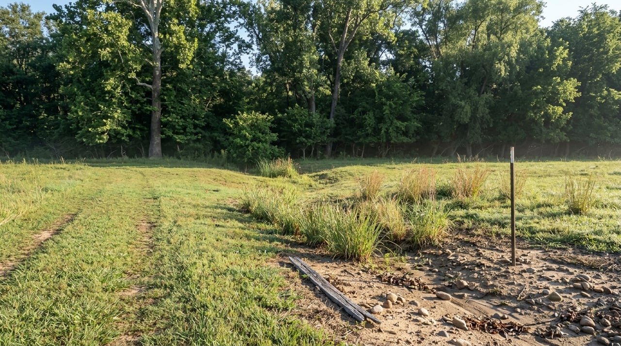
Screen floodplain risk early
Flood screening should be one of your first steps with any Arthur City river tract. A beautiful low area near the water may fit your vision, but you need to know whether it falls in a mapped flood zone and how that might affect financing, insurance, access, or future building plans.
FEMA identifies Special Flood Hazard Areas as areas subject to the base flood, which is the 1% annual chance flood. FEMA’s Map Service Center is the official place to check flood maps. Texas Parks and Wildlife also notes that work in the 100-year floodplain may require approval from the local floodplain administrator.
The practical takeaway is simple. Flood maps, lender requirements, and local drainage rules are related, but they are not the same thing. A tract may look usable on the ground and still require extra review before you build or improve it.
Floodplain questions to ask
- Is any part of the tract in or near a FEMA flood zone?
- Is there a home, barn, or other structure in a mapped flood area?
- Has anyone obtained an elevation certificate if a structure is involved?
- Has the local floodplain administrator been consulted for proposed work?
Soil matters more than many buyers expect
Acreage near the river can vary a lot from one tract to the next. Soil affects drainage, seasonal wetness, septic suitability, pond construction, and how practical the land will be for your intended use.
The NRCS Web Soil Survey is the authoritative online source for current soil survey information, but NRCS also notes that onsite investigation is still needed in some conservation and engineering situations. In other words, online mapping is a strong starting point, not the final word.
For buyers in Arthur City, soil questions should focus on drainage, wetness, septic performance, and whether the tract has enough clay or too many fragments for pond-building plans. NRCS pond work in Lamar County found that pond suitability can depend on clay content, rock fragments, and bedrock depth, and one local site was not suitable for a pond because of fragments and bedrock.
The Lamar soil series is one example of how local variation matters. It is a well-drained upland soil, not a floodplain soil, which is a reminder that countywide assumptions are less useful than parcel-level mapping.
Verify utilities on the ground
With rural property, you do not want to rely on a listing summary alone. AgriLife advises buyers to budget for water infrastructure, access improvements, fencing, roads, gates, and utilities, and to verify road and emergency access early.
That matters in Arthur City because some tracts may have part of the utility package in place, while others may need major investment before they are ready for a home site, recreational use, or livestock operation. A simple phrase like “utilities available” may not tell you enough.
Utility items to confirm
- Public water, private well, shared water system, or no water source
- Existing electric service status
- Drive and road condition
- Gate and fencing condition
- Emergency access practicality
- Whether utility easements affect building areas
Wells, septic, and water use rules
If the property relies on a private well, water quality and maintenance become your responsibility. AgriLife says private well owners should test water at least once a year, and TCEQ also states that private well owners are responsible for regular testing.
If the tract needs septic, TCEQ says onsite sewage facilities require permits and approved plans for construction, alteration, repair, extension, or operation. The system must be designed from a site evaluation that accounts for local conditions, and local permitting authorities can be stricter than state minimums.
If you are thinking about using river water for irrigation, livestock, or a pond-related purpose, do not assume that river frontage gives you automatic use rights. TCEQ says surface water in Texas is state water, and a permit is generally required unless the use falls under a limited exemption such as domestic, livestock, wildlife management, or emergency use.
Match the tract to your intended use
AgriLife identifies common rural land goals as livestock production, wildlife management, recreation, and long-term investment. Those are all realistic reasons to buy acreage in and around Arthur City, but each goal depends on different property features.
If you want cattle, you will likely focus on fencing, water, access, and usable pasture. If you want recreation, the exact boundary, access route, and river use rules matter more. If you want to build, then floodplain position, soils, water, and septic suitability move to the top of the list.
The best tract is not just the one with the prettiest river setting. It is the one that supports your actual plan without too many unanswered questions.
Review tax treatment before closing
Property taxes are a major part of the ownership picture for larger tracts. In Texas, the Comptroller says qualified land can receive agricultural, timberland, or wildlife-management special appraisal based on productivity value instead of market value.
That can be helpful, but buyers should also understand the risk of rollback tax if the use changes to a non-ag use. Before closing, verify the property’s use history, current appraisal status, and local intensity standards with Lamar CAD.
Read the listing details carefully
River acreage listings can sound straightforward while leaving out important details. The most useful listing information usually includes legal access, road frontage, flood-zone language, survey status, water source, septic status, easements, mineral reservations, and any restrictions on use.
AgriLife specifically warns buyers about unclear access, missing or outdated surveys, undisclosed easements, limited water information, and deferred infrastructure maintenance. If a listing is thin on details, that is not always a deal breaker, but it is a reason to ask better questions.
A current survey is worth it
For acreage near the river, a current survey is one of the smartest investments you can make. AgriLife says a survey should confirm boundaries, acreage, legal access, encroachments, and rights-of-way.
Texas rules also make this clear from a professional standpoint. Surveying services must be performed by duly licensed and registered persons, and property descriptions tied to a boundary survey must be signed and sealed by a Registered Professional Land Surveyor.
If there is a structure in a mapped flood area, an elevation certificate may also come into play. FEMA’s instructions state that the form is completed by a land surveyor, engineer, or architect authorized by state law.
A practical buying checklist
Before you move forward on acreage near the river in Arthur City, make sure you can clearly answer these questions:
- Where does the surveyed boundary end near the riverbank or streambed?
- Is access recorded and legally usable year-round?
- Are there easements that affect building, fencing, utilities, or drainage?
- Is the tract in or near a FEMA flood zone?
- What do the soils suggest about drainage, septic, and pond potential?
- What is the real water setup: public, well, shared, or none?
- If there is a well, is there a recent water test and maintenance record?
- If septic exists or is needed, are permits and site evaluations in place?
- Are any minerals reserved or leases in effect?
- Does the current tax treatment fit your plans, and could a use change trigger rollback tax?
Buying river acreage is rarely about just one feature. The strongest purchases happen when the land, access, utilities, and paperwork all support the way you want to use the property.
If you are considering acreage in Arthur City or anywhere around Lamar County, working with a local land-focused agent can help you spot questions early and avoid expensive surprises later. When you want practical guidance on rural property, access details, and what to verify before you close, reach out to Meagen Smith.
FAQs
What should you check first when buying acreage near the river in Arthur City?
- Start with legal access, floodplain screening, and a current survey so you know how the property can actually be reached, used, and evaluated.
How do flood zones affect Arthur City river acreage?
- A tract in or near a FEMA flood zone may face added review for financing, insurance, and improvements, and some work in the 100-year floodplain may require local approval.
Why does a survey matter for river property in Arthur City?
- A current survey helps confirm boundaries, acreage, legal access, encroachments, and rights-of-way, which is especially important when land borders the river.
What utility questions should you ask about Arthur City acreage?
- Ask whether the tract has public water, a private well, a shared system, or no water source, and verify electric service, road condition, gates, fencing, and emergency access.
Can you use Red River water if your Arthur City property touches the river?
- Not automatically, because TCEQ says surface water in Texas is state water and a permit is generally required unless a limited exemption applies.
How do soils affect plans for Arthur City river acreage?
- Soils can influence drainage, seasonal wetness, septic suitability, and whether a pond is practical, so parcel-level soil review is important before you buy.
What should you know about property taxes on Arthur City acreage?
- Some land may qualify for agricultural, timberland, or wildlife-management special appraisal, but a change in use can trigger rollback tax, so buyers should verify status with Lamar CAD before closing.